There are not many things one can look forward to in this benighted age. It used to be that one could count on a novel from the the late and lamented Elmore Leonard with regularity (one hopes that his estate doesn’t go the crass and sham “Elmore Leonard novel written by…” route). One thing that I look forward to with gleeful expectation is receiving Oxford University Press’s annual update of their Atlas of the World every October. Given my vow to avoid being treated as a bovine and thus never fly again (unless I am granted 1st class ducats), most of my traveling is left to my trusty vintage ragtop and an imagination sparked by luxurious and vivid tomes like OUP’s Atlases.
As the Oxford University Press points out the Atlas of the World -21st Edition is the only world atlas updated annually.There is a 48-page Introduction to World Geography and detailed presentations of crucial geographic issues —food and water supply,global conflict, human health,standards of living, climate change,biodiversity, energy, and landforms. The 21st edition has a six-page special on “The Future of the Oceans and Seas,” and eleven new images acquired from NASA’s latest Earth Observation Satellite, Landsat 8. Per usual the hundreds of city and world maps in the Atlas have been rigorously updated as well as the inclusion of innumerable obscure by interesting details. Measuring 14 inches by 18 inches, its a splendidly reproduced book, worthy of any coffee or kitchen table.
Maps: their untold stories by Rose Mitchell, Andrew Janes (Bloomsbury)
Just as cordless and smart phones have obviated the need for remembering phone numbers, Global Positioning devices have made map reading an elective activity. Maps: their untold stories by Rose Mitchell, Andrew Janes (Bloomsbury)collects maps from 14th Century manuscripts, through early estate maps, to sea charts, maps used in military campaigns, and maps from treaties, all drawn from Britain’s National Archives.It’s a thoughtfully curated collection with explications of some odd maps and their uses such (to quote the book’s website)”a woodcut map of 16th Century London, a map of where the bombs fell during the Second World War, and a map the first American settlers’ drew when they were attempting to establish a new empire on Roanoke Island, off the coast of what is now North Carolina…the map of the Great Exhibition in 1851 that was presented on a lady’s glove, a London Underground map in the form of a cucumber, and a Treasure Island map used to advertise National Savings.”
Being far and long removed from the age of exploration when the only means of long distance travel were horses and ships and the planet was a great expanse of unknown we take knowledge of our geographical position for granted.Needless to say it was not always so— Ships, Clocks, and Stars:The Quest for Longitude(Harper Design) by Richard Dunn and Rebekah Higgitt recounts the eighteenth-century quest to solve the so-called “longitude problem” and thus accurately verify a ship’s position at sea. Well illustrated with more than 150 photographs from Britain’s National Maritime Museum,this is one of the great scientific adventure stories.
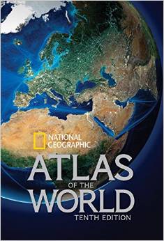
The 10th edition of National Geographic Atlas of the World coincides with the 100th anniversary of National Geographic cartography. Completely updated and expanded by sixteen pages,this titanic slip cased tome (12″ x 17″) is an authoritative reference and includes the largest and most comprehensive collection of political maps ever published by National Geographic. The update includes new maps of Ireland, Scotland, England and Wales, three detailed regional maps of Australia, expanded coverage of Africa, and a map of the strategically important area around the Mediterranean Sea, encompassing North Africa and Southern Europe. There is an expanded place-name index with more than 150,00 entires, and separate undersea, Moon, and Mars features. The sizable back matter includes flags and facts for all 195 extant nations, geographic comparisons, world time zones, metric conversion tables, and such.
Currently reading The Perfect Spy by John LeCarre (Penguin)


Leave a comment